Search This Blog

Monday, 21 October 2013

South Coast trip, part 5

The Pinnacles are between Pambula and Eden in Ben Boyd National Park. They look for all the world like the areas of California where gold miners practised "sluicing" (or the gold fields in Victoria where the same operation took place, like Oriental Claims), as I posted last year.

But, it seems, this is all natural. The white sandstone was below an ancient water table, the red was above.  Inter4esting, but not highly important in my mind.


Up north, on our way home, Myrtle Beach was important. I am fascinated by unconformities, and I will be off in about six weeks to revisit another one and to record it properly.

An unconformity is a gap in the geological record, but before we get to that, a bit about getting there, because the published details in an otherwise very useful leaflet called Ancient sites: a geological journey, left a lot to be desired.  Here is my take on it:

On the highway, take the South Durras turn-off about 10 km north of Bateman's Bay: it is well sign-posted. Follow the signs to the Murramarang Resort, ignoring the leaflet.

On the far side of the car park, you come to this sign, which is between two roads.  I took the right fork, and that worked.  Drive along to the Myrtle Beach/Dark Beach turn-off and drive to the parking area.


The sign below shows you where to go. Follow the path for about 250 metres (leaflet says 200) and look for an unmarked path on the right, going downhill with log "steps".


Close to the beach, you will come to some timber steps. Somebody has written on these that the beach is a nude beach. There was nobody there, so we had no idea whether the sign has any validity and didn't care.

At the bottom of the steps, we turned left (north) and walked along the grassed area at the back of the beach, until we saw this, perhaps 60 metres from the steps.  This is it.

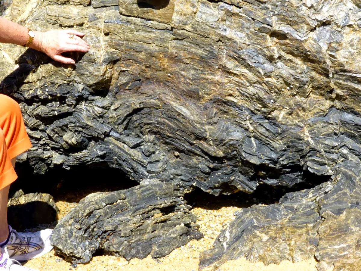
It isn't all that obvious, but the beds coming out of the ground are tilted and obviously metamorphic, unlike the rubbly conglomerate just above.  Look closer, where Chris is pointing:


And closer again:

And even closer. Her hand is spanning about 150 million years of history, because the old Ordovician rocks were buried deep, metamorphosed by heat and/or pressure, tilted, uplifted, eroded, and then cast down into a deep depressions where new sediments could be deposited, some time in the Permian.


Pretty neat, huh?  Chris was neat, too.  On the way up, she spotted these tilted beds behind the first landing on the stairs. This reminds us that the base level that the first sediments were dumped into was by no means a level area: these would be 8-10 metres higher than where Chris had placed her hand on the boundary.


Links to the other four parts:

Part 1
Part 2
Part 3
Part 4

South Coast trip, part 4

Bingie Bingie Point is south of Moruya: turn off at Bergalia.  It offers two interesting dykes.  The first one is basalt cutting through granite, though curiously, there seems to be a granite dyke running down the centre of the basalt: I assume that what has happened is that the basalt came up both sides of a sliver of granite. That was on the southern side.


 After scrambling over boulders, we got onto the point and headed out to where we found what Chris found in one of the pamphlets was said to be an aplite dyke: that's the pink rock.
 
 A close view of the margin, showing the granite as well.

 And here is what appears to be a later basalt dyke, running through the aplite. Can anybody comment helpfully on this and set me straight?


 If you look carefully, the basalt is cutting across the aplite!


Cuttagee is south of Bermagui. We only stopped off there because there was a lagoon that I wanted to photograph, but we found these (tested for hardness) quartz veins in a sort of sandstone, and above, some interesting honeycomb weathering in the headland at the northern end of the beach: we could access it at high tide.


Next time: The Pinnacles, and Myrtle Beach, which has an unconformity, as it lies at the base of the Sydney Basin.

Links to the other four parts:

Part 1
Part 2
Part 3
Part 5

South Coast trip, part 3

Let's start with Camel Rock, about five minutes' drive north of Bermagui. The rock gets its name from the distinctive shape, as seen by Bass and Flinders in an early mapping trip along the coast.

 This is a great place to sample Ordovician turbidites, sedimentary rocks that formed on a deep ocean floor when unstable sediments avalanched down the continental slope, sorting as they went and slumping and bending as more weight was dumped on top of them. This shot is a little hazy, as it was taken during the October 2013 NSW bushfires.

Here is a clearer, more close-up shop, where you can see that some of the jagged bits are actually birds:


 This is the place for folds and curly stuff.


The scale here, and in all of the photos where it appears, is a 50-cent coin which is 32 mm across. Now here is some faulting, in two views.


We got more of the same at Mystery Bay, which got its name when a geologist and his party disappeared:

From somewhere else, I gathered that the boat was not only holed, but it was stove out, rather than stove in, indicating foul play, as did the presence of personal property in the boat. There is more detail here. The source is the Illustrated Sydney News of November 20, 1880. If you turn over to page 12, you will find this picture:


 But we were here for the rocks, so here are some of them: enjoy!


 The second shot below has a 32mm 50-cent coin for scale.


Next time: Bingie Bingie point with dykes and some interesting Cuttagee sedimentaries.

Links to the other four parts:

Part 1
Part 2

Part 4
Part 5

South Coast trip, part 2

Now for some serious geology.

The area we were working along contains rocks as old as 510 million years, and it is a coastline that developed 90 to 70 million years ago, at a time when there were still dinosaurs around.  That was when the Lord Howe Island Rise came away from the Australian mainland and set off out into the Pacific.

Mind you, the actual coastline is even newer, because in the past few million years, sea levels have gone up and down, due to assorted ice ages taking water out of the oceans.  This is good, though, because it exposes fresh rocks at regular intervals.

We have faulted, folded mudstones, cherts, basalt intrusions and blocks of granite as well, all mixed in together.  As I indicated in Part 1, I am no geologist., just a rock watcher, so none of my comments should be taken as gospel, though they are reasonable commonsense in most cases.
Mimosa Rocks
 The Mimosa Rocks National Park lies between Bermagui and Tathra, and takes its name from a paddle steamer that was wrecked near there in 1863.  Most references seem to suggest that she was wrecked on the rocks, but the captain of Mimosa reported striking a "detached rock", a mile off shore.

Still, the pyramid form that you reach by heading north from the Aragunnu Beach car-park is worthy of note for the rhyolite capping which shows columnar jointing which is more visible here, where I zoomed in:


 There was more fun to be had down on the shore, where there were some cliffs worth looking at: to my eye (note the qualifier!!), these appear to be faulted and folded varved shales.

Then there were the pebble beaches:

 And in the distance, a strange white rock:

 A closer look solved the mystery, it was covered with seabird by-products. I should have known!

 We then headed north into the Tilba Valley, stopping at Central Tilba for shopping, Devonshire tea and this shot of a rather impressive granite dome, which is actually on the other side of the highway:
Then we headed north, looking for 1080 Beach (pronounced ten-eighty). The name 1080 is used for a rabbit poison which is actually sodium fluoroacetate, but I have no knowledge of the origin of the beach's name.

The beach is little known in the area, so here are instructions:

Drive to Mystery Bay, about 10 km south of Narooma.  Follow the tar until you see the sea, go right into Lamont Young Drive on a good road, looking out for a National Parks road with cryptic signage on the left.  Find that road and drive carefully (it's narrow, with many blind corners: I used my horn quite a bit) along to the end, where there is a car park. Find your way down to the beach.

It's worth it for this dyke:


Incidentally, on the way in and out, watch out for locals:

Next time: Camel Rock and Mystery Bay.

See also 

* Rhyolite-Basalt-Soft Sediment Relationships at Bunga Beds, Aragunnu, Mimosa Rocks, Southern NSW, Australia;

* The Story of Granite and Bega Cheese.

Links to the other four parts:

Part 1

Part 3
Part 4
Part 5


South Coast trip, part 1

This portion of my blog will be in about half a dozen parts.  Each will be packed with photos taken on a recent trip down the NSW coast, mainly about geology, though we will start off with some biology, because that was how it panned out.  This is general research and backgrounding for a couple of books that are in the pipeline

Our centre of operations was Bermagui, about 400 km south of Sydney, and the purpose was to gather material for an upcoming book.

We worked known geological sites, and prowled the areas to see what else was around.  Please note: I am not a geologist, and my conclusions, while reasonably informed, are open to question.

Our first beach was Barragoot, south of Bermagui, and that was mainly to look at the dunes there for yet another book. Still, no sooner had we set foot on the southern end, where a lagoon feeds into the sea, than we had a major find:

 These four pictures show (I think) a male red-capped plover. My confidence was increased when I managed to get the next two shots:


I believe that the bird on the left in the first shot, and on the right in the second shot is a female. This plover is classed as endangered: it nests on the open beach. We learned about it on a previous field trip when we mistook another bird for this one.

Well, that messed up our plans for the beach a bit, because we needed to stay off the dry sand at the back of the beach, but we headed several hundred metres down the beach before veering up, once we had left the parent birds well behind.  Even so, we were very cautious.

We worried, though, because of some strange tracks that we found, the ones you can see here to either side. They appeared to be made by a heavy animal, perhaps hopping on one leg.  For the most part, they were too indistinct for us to recognise.

We followed them along until we came to these, which looked rather more like a four-legged carnivore. People are usually barred from walking dogs in areas where the plovers nest, but there were no accompanying human tracks.

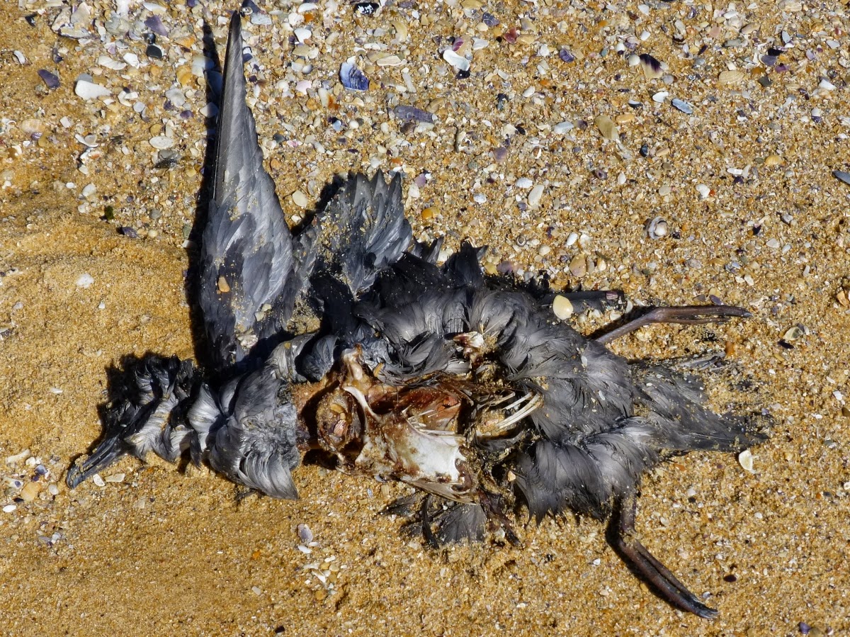
I just hope the birds are OK. There were quite a few birds on the beach that were not OK, and it seems that quite a few shearwaters (alias mutton birds) have been dying off the coast.

These wash ashore and provide food for a variety of life forms: small land shrimps, about 4 mm long, small earwigs, and also crows.

Life goes on.

So did we, having sated our interest in matters biological, we headed on down to bother the rocks at the southern end.

The rocks of the south coast are curious. At Myrtle Beach, near Durras Lake, the base of the Sydney Basin rises above sea level, and I will come to that in a later post.

All of a sudden, we go from early Permian, maybe 300 million years old, to Ordovician, perhaps 450 to 500 million years old. That means the rocks we were looking at had a great deal of history: they had been formed, buried, heated, run through by hot liquids, maybe even by molten rock, they have been bent and bashed, so there is always some mystery there.

The veins you see here have to be quartz, because I succeeded in scratching a glass bottle on them, but I confess my ignorance as to what that means.

More Research Needed!

Next time: folds and faults at Aragunnu, bird-covered rocks, a dyke, an intrusion, and some columnar-jointed rhyolite at Mimosa Rocks.

For more stuff like this:
I add tags to all of my blogs, and my tags are fairly WYSIWYG. Look further down, and click on one of the links.

Or

See also:

* Sapphire Coast Geo Trails, part 1, Bermagui and North.

* Sapphire Coast Geo Trails, part 2, Bermagui to Tathra.

* Sapphire Coast Geo Trails, part 3, South of Tathra.


Links to the other four parts:


Part 2
Part 3
Part 4
Part 5